Rangers take the lead as ‘eyes and ears’ of the Northern Great Barrier Reef

Rangers take the lead as ‘eyes and ears’ of the Northern Great Barrier Reef

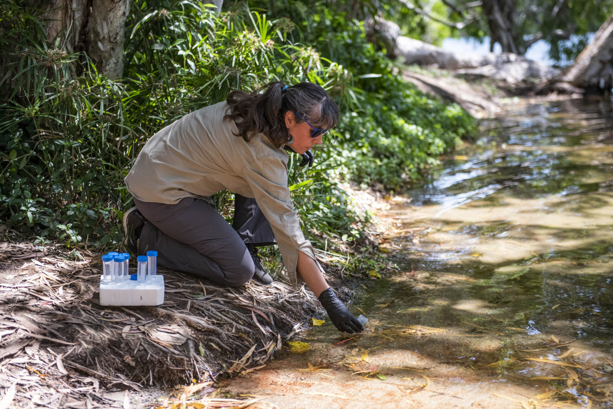
In the lead up to National Reconciliation Week (27 May – 3 June), James Cook University’s scientists are this week upskilling Torres Strait rangers to be the eyes and ears in protecting seagrass meadows in the northernmost part of the Great Barrier Reef.

In one of the country’s most comprehensive seagrass monitoring programs, Torres Strait Regional Authority (TSRA) and JCU TropWATER Centre are together training rangers from remote island communities to monitor seagrass meadows in the nation’s far north.

TSRA Acting Chairperson Horace Baira said Green Island off Cairns – home to vital dugong and turtle seagrass habitat – provided the perfect training ground.

“Combining ancient knowledge and modern science is critical for conservation as we face climate impacts across the Torres Strait,” Mr Baira said.

“The ocean is the lifeblood of the Torres Strait and bringing together all fields of expertise will help protect this precious natural resource for current and future generations.”

JCU’s TropWATER Centre seagrass scientist Dr Alex Carter said the rangers were critical in regional assessments of seagrass condition in Torres Strait.

“This training week builds on a 15-year partnership that goes from strength to strength as it continues to grow with new monitoring locations added to the network,” she said.

“Traditional Owners are the eyes and ears on the ground and this ranger-led program provides the first warnings of any declines or changes in seagrass health.

“This allows for quick management responses and targeted research projects to protect these important seagrass meadows.”

The four-day workshop, delivered by JCU scientists and TSRA, includes in-field training, species identification, and an opportunity to discuss results from recent research and monitoring projects to plan for future opportunities.

24-year-old Iama (Yam) Island Traditional Owner and TSRA Marine Biologist Madeina David said the training would support reef monitoring and results.

“Most people are unaware the Torres Strait is the most northern part of the Great Barrier Reef, home to the world’s largest dugong population and significant numbers of green turtles,” Ms David said.

“Working in partnership to value both traditional and western science gives our marine life and ocean ecosystems the best chance to survive and thrive.”

Meriam Traditional Owner and TSRA Senior Ranger Supervisor Aaron Bon said the training would build the capacity and knowledge of local Torres Strait Islander and Aboriginal rangers and boost conservation efforts across the Torres Strait.

“It will also assist Rangers and Traditional Owners to keep an eye on our reefs and seagrass meadows in the region and in doing so, we help protect some of the world’s most pristine and rich sea country,” Mr Bon said.

“Rangers will bring back skills, share learnings to support our important work on land and sea country in remote island communities and help us to make informed decisions around where we need to target our conservation efforts.”

TSRA employs up to 60 land and sea rangers across 14 Torres Strait communities to support employment opportunities for local people to combine traditional knowledge with conservation training to protect and manage land, sea and culture.


Turtles, dugongs in danger from seagrass loss

Large-scale monitoring of seagrass meadows across Hervey Bay and the Great Sandy Strait reveals there’s almost no seagrass remaining across most of previously mapped areas.

The surveys come after two significant flood events in early 2022, and scientists are concerned the seagrass loss could trigger an increase in dugong and green sea turtle strandings.

James Cook University TropWATER Centre is leading the monitoring of 2300km2 of seagrass meadows – one of the largest and most important areas of seagrass in eastern Australia – in partnership with the Department of Environment and Science (DES).

TropWATER Professor Michael Rasheed said there had been drastic reduction of seagrass when compared with previous extensive mapping.

“Our boat surveys show there’s almost no seagrass visible in the 2m to 17m depth range for much of the deeper meadows, and these sites have previously recorded extensive areas of seagrass,” he said.

“There were some areas of sub-tidal seagrass but these were confined to the deepest areas in the northern part of the bay.

“We also used helicopters to assess more than 1300 intertidal sites throughout the Great Sandy Straits and while some sites had seagrass the cover was typically less than one percent of the seafloor offering scant resources for dugong and turtle.”

Prof Rasheed said the last comprehensive mapping of the entire area was more than 20 years ago, and surveys now were critical to help understand what seagrass resource remains to support dugong and turtle feeding as well as assess the potential for recovery over the coming months.

“However, we are in the low season for seagrass growth and about to enter the recovery period for seagrasses, so we hope to return to these waters in September/October, the normal seasonal peak for seagrasses, to look at how much of the seagrass has recovered.

“The good news is that there is still some seagrass remaining and this can provide the source for recovery in the coming months if conditions are favourable.”

In 1991 the same region experienced back-to-back floods causing more than 1000 km2 of seagrass loss.

Sediment in the floodwaters is known to reduce light and smother seagrass meadows, potentially depleting the main food source for dugong and turtles in the area.

The following year saw the highest recorded mortality of dugong, including a 20 per cent decline in dugong calves.

Queensland Parks and Wildlife Service Senior Ranger Dan Clifton said rangers had seen an increase in marine strandings within the Great Sandy Marine Park over the past 12 months, with the recent floods contributing to the issue.

“Since July 2021 we have recorded more than 240 stranded marine turtles and 22 stranded dugongs in this area as a result of different factors including boat strike and poor health,” Senior Ranger Clifton said.

“These numbers are significantly greater than the long-term average in the area.

“We have also recently seen large, mature green turtles presenting with an ulcerative skin disease affecting the carapace and flippers. This is currently being investigated by leading authorities to determine causes so we can respond accordingly.

“The issues currently faced by marine wildlife in the Great Sandy Marine Park demonstrate the importance of ongoing research and surveys so that we can identify and respond to threats and how critical it is that we protect our precious ecosystems.”

Alongside the seagrass monitoring, TropWATER researcher and dugong expert Dr Chris Cleguer is trialling the use of drones to monitor the body condition of the dugongs in the area.

“Extensive seagrass loss can have dramatic impact on dugongs and sea turtles. Dugongs may stop breeding, some will move and some will die,” he said.

“Assessing changes in the body condition of dugongs can help us monitor the health of the animals following the flooding events in the Hervey Bay region.

“Drones are increasingly used as a low-cost, non-invasive approach to obtain morphometric measurements of marine mammal body size. It’s been done for whales and manatees, and now we’re starting to collect data to do the same for dugongs.”

The large-scale monitoring also includes the collection of sediment samples from the seafloor to better characterise the fine sediment that surrounds the seagrass meadows and the source of these sediments.

TropWATER researchers and rangers from Queensland Parks and Wildlife Services will today finish the 14-day assessment of deep-water and shallow-water habitats across Hervey Bay and the Great Sandy Strait, using aerial and boat surveys.

Final results from the survey will be available in the coming months.

Dramatic loss of globe’s wetlands

Researchers analysing more than one-million satellite images have discovered 4,000 square kilometres of tidal wetlands have been lost globally over twenty years – but ecosystem restoration and natural processes are playing a part in reducing total losses.

Dr Nicholas Murray, Senior Lecturer and head of James Cook University’s Global Ecology Lab, led the study. He said global change and human actions are driving rapid changes of tidal wetlands —tidal marshes, mangroves and tidal flats — worldwide.

“But efforts to estimate their current and future status at the global scale remain highly unclear due to uncertainty about how tidal wetlands respond to drivers of change.

“We wanted to address that, so we developed a machine-learning analysis of vast archives of historical satellite images to detect the extent, timing and type of change across the world’s tidal wetlands between 1999 and 2019,” said Dr Murray.

TropWATER’s Nathan Waltham, and co-author on the study, said wetland loss in the Great Barrier Reef was a major concern.

“Coastal wetlands provide many services such as habitat for fish, cultural values, carbon storage and water quality,”  said Dr Waltham.

“We are working closely with many partners including NRM groups, farmers, Land and Sea Ranger groups, government and industry to protect and restore coastal wetlands at home here – but it is a big job and much work is needed.”

Dr Murray said that globally, 13,700 square kilometres of tidal wetlands were lost, offset by gains of 9,700 square kilometres, leading to a net loss of 4000 square kilometres over the two-decade period.

“We found 27 per cent of losses and gains were associated with direct human activities, such as conversion to agriculture and restoration of lost wetlands. All other changes were attributed to indirect drivers such as human impacts to river catchments, extensive development in the coastal zone, coastal subsidence, natural coastal processes and climate change,” said Dr Murray.

He said about three-quarters of the net global tidal wetland decrease happened in Asia, with almost 70 per cent of that total concentrated in Indonesia, China and Myanmar.

“Asia is the global centre of tidal wetland loss from direct human activities. These activities had a lesser role in the losses of tidal wetlands in Europe, Africa, the Americas and Oceania, where coastal wetland dynamics were driven by indirect factors such as wetland migration, coastal modifications and catchment change,” said Dr Murray.

The scientists found that almost three-quarters of tidal wetland loss globally has been offset by establishing new tidal wetlands in areas where they formerly did not occur – with notable expansion in the Ganges and Amazon deltas.

“Most new areas of tidal wetlands were the result of indirect drivers, highlighting the prominent role that broad-scale coastal processes have in maintaining tidal wetland extent and facilitating natural regeneration. This result indicates that we need to allow for the movement and migration of coastal wetlands to account for rapid global change,” said Dr Murray.

He said over one billion people now live in low-elevation coastal areas globally.
“Tidal wetlands are of immense importance to humanity, providing benefits such as carbon storage and sequestration, coastal protection, and fisheries enhancement.
“Global-scale monitoring is now essential if we are going to manage changes in coastal environments effectively,” said Dr Murray.

Wuthathi Land and Sea Custodians partner with TropWATER scientists

Wuthathi Land and Sea Custodians will use drone, helicopter and drop camera surveys to map seagrass habitats on Wuthathi Sea Country in Northern Cape York, in partnership with TropWATER scientists.

Combining cutting-edge technology, science and Traditional Ecological knowledge, the data collected will give Land and Sea Custodians and Traditional Owners the tools to develop plans for future monitoring and management of seagrass on Wuthathi Sea Country.

TropWATER is working alongside Wuthathi Land and Sea Custodians to conduct these surveys, helping to develop capacity in drone flight path programming, image collection and recording of data on sea grass habitat.

The partnership will expand to helicopter and drop camera survey training later this year, where Wuthathi Land and Sea Custodians will be upskilled to undertake aerial and subtidal surveys to monitor inshore seagrass meadows.

The program is funded by the partnership between the Australian Government’s Reef Trust and the Great Barrier Reef Foundation.


Long lost ‘bum-breathing’ turtle makes its return

A revolutionary new DNA detection method has helped rediscover an iconic species of turtle last seen more than 25 years ago in a northern Queensland river.

Water samples taken from the lower Burdekin River by a James Cook University-led team of researchers and analysed for environmental DNA (eDNA) confirmed the presence of the Irwin’s turtle at many sites along the river, which has not been formally recorded in the area for more than 25 years.

The turtle, first discovered in the Burdekin catchment by the late Steve Irwin and his father Bob in the early 1990s, is among a number of freshwater species which uses its cloaca (equivalent to its bum) to breathe while underwater, thus able to stay submerged underwater for longer.

Centre for Tropical Water and Aquatic Ecosystem Research (TropWATER) Director Professor Damien Burrows and Research Officers Dr Cecilia Villacorta-Rath and Jason Schaffer teamed up with a State Government agency, a consultancy firm and Traditional Owners to survey the Burdekin, Bowen and Broken rivers for the elusive turtle.

“Until this rediscovery, we didn’t have any formal records to prove that the Irwin’s turtle was still living in the lower Burdekin River, and that river has changed a lot since the construction of the Burdekin Falls Dam,” Prof Burrows said.

“It’s reassuring to know they are still living there.”

The survey findings, co-authored by the JCU team and the Department of Regional Development, Manufacturing and Water’s Thomas Espinoza and Bernie Cockayne, were published this week in BMC Ecology and Evolution journal following two years of research comprising three separate survey periods over 2020 and 2021.

Funded by the National Environmental Science Program, 37 sites were investigated across the three river catchments, some of which involved the use of helicopters to get in and out.

Prof Burrows said eDNA technology was vital to the rediscovery of the turtle in the lower Burdekin River and had the potential to revolutionise how researchers tracked and located both aquatic and land-based animals.

“Previously, it’s been very difficult to sample for the Irwin’s turtle because they only live in places where there are crocodiles, or in upland tributaries which are very hard to access,” he said.

“They also don’t come into traps easily and the water they are living in in the Burdekin isn’t clear so you can’t put in underwater cameras to see them.

“But now with eDNA, all we had to do was take a water sample and analyse for their DNA.”

With the new process, DNA itself can be extracted and amplified directly from environmental samples such as soil, sediment and water without having to catch the target organism.

Dr Villacorta-Rath said while the eDNA samples taken by the team could not determine the age of the turtles found in the lower Burdekin and other rivers surveyed, the results were potentially game-changing.

“With the original site samples that we took in 2020, we had the beginnings of the story, but we needed to investigate further and go closer to the dam and see where was the uppermost distribution of the species,” she said.

“We don’t know anything about the demographics of this population, but the fact we have found their eDNA now, despite the dam being built in the 1980s, could point to adult Irwin’s turtles being able to survive in these more turbid water conditions.

“This rediscovery has now challenged the previous hypothesis that the species could not survive in these conditions.”

The information gathered will also help the State Government as it evaluates a proposal to build a dam in the upper reaches of Broken River at Urannah Station

Studying dugongs from the sky

Drones could fast-track how scientists collect data on one of the most elusive marine mammals in the Great Barrier Reef.

Dr Chris Cleguer is trialling the technology to search for dugongs in a known hotspot just off Townsville at Cleveland Bay, recording more than 55 kilometres of dugong habitats rich with seagrass meadows.

The trials tested the feasibility of conducting a vessel-based drone survey in the inshore waters of Cleveland Bay with the ultimate goal of getting a better understanding of the dugongs’ dynamic habitat use in the area. 

We know Cleveland Bay is one of the most important dugongs’ hotspots in the Great Barrier Reef, but these animals are notoriously difficult to study, and we know little about how dugongs use the Bay,” he said.  

New technologies such as drones and aerial imagery have the potential to be a complete game-changer in how we try to safely and cost-effectively unveil how dugongs use the area.

Cleguer is also teaming up with Dr Fredrik Christiansen from Aarhus Institute of Advanced Studies (Denmark) to develop a method to use drone imagery to assess the body condition of dugongs. This research is looking at how to enhance the capacity to assess the condition of dugong populations. 

‘Turtle gate’ gives safe passage in feral pig dilemma

Native freshwater turtles have been caught in the battle to keep feral pigs out of coastal wetlands, with many adult turtles becoming fatally trapped by fences.

But now, scientists and Traditional Owners on Cape York Peninsula have found it’s possible to keep the destructive pests out and give turtles safe passage to move between water bodies during critical lifecycle periods.

It’s called a ‘turtle gate’ and any freshwater floodplain fence can be modified to include it by removing a small section of wire, with little more than a pair of pliers.

The research, led by James Cook University’s Centre for Tropical Water and Aquatic Ecosystem Research (TropWATER), shows the modifications can be made to the most common exclusion fences used in Australia.

TropWATER Principal Researcher Dr Nathan Waltham said many inland wetlands tend to dry out entirely in the dry season, resulting in the migration of freshwater species.

“These freshwater turtles need to make the very slow journey across land, from one wetland to another waterhole,” he said.

“In cases where fences have been built around wetlands to protect them from feral animals, we found many turtles simply became stuck either inside or outside of the wetlands.

“Without being able to move to another river or creek, turtles would often not survive either because of dehydration or from starvation.”

The research showed any freshwater turtle with a shell width greater than the diagonal wire gap would likely become trapped, limiting their ability to access nesting sites, other waterholes, mates and food.

“These turtle gates are a fast and cost-effective solution, which could be included by landholders or local rangers,” Dr Waltham said.

The research was funded by the Australian Government’s National Environmental Science Program through the Northern Australia Environmental Resources Hub.

North Australian Indigenous Land and Sea Management Alliance Research Manager Dr Justin Perry said feral pigs were the worst invasive mammal in Australia and managing the feral animals was a “hard balance” to get right.

“Pigs can contaminate water sources and quickly destroy a wetland in just a few days, decimating crucial habitats for native plants and animals,” he said.

“Fences are a common management solution and our project partners on Cape York, Aak Puul Ngantam (APN) and Kalan Enterprises, have been using fences to protect wetlands for many years.

“We know that well maintained fences do a good job at keeping pigs out, but we need to take into account what these exclusion fences could be doing to native species.

“These small modifications could save many turtles already caught in challenging floodplain environments.”

The study Simple fence modification increases land movement prospects for freshwater turtles on floodplains was published in Wildlife Biology, authored by Nathan Waltham, Jason Schaffer, Sophie Walker, Justin Perry and Eric Nordberg.


-END-

For more information contact:

TropWATER Communications, JCU: Molly.mcshane1@jcu.edu.au, 0448015278

Lead scientist, Dr Nathan Waltham: nathan.waltham@jcu.edu.au


Using genetic clues in the race to find ‘missing’ frogs

Genetic clues in the water could lead scientists to the last surviving populations of frogs on the brink of extinction – and it could be our last hope to find them.

For decades, scientists have slowly scoured remote mountain ranges in search of rare frog species that have vanished from the wilderness, often to no avail.

But in new research, scientists from James Cook University’s Centre for Tropical Water and Aquatic Ecosystem Research (TropWATER) have found it’s possible to find traces of a frog’s environmental DNA (eDNA) in catchments more than 20 kilometres downstream from their habitats.

TropWATER geneticist and co-lead author Dr Cecilia Villacorta-Rath said the eDNA tool could revolutionise the search for some of Australia’s critically endangered frogs.

“When frogs visit water streams they shed bits of their genetic material, such as skin, urine, saliva, faeces and blood into the water,” she said.

“This eDNA travels kilometres downstream to feed into a bigger catchment – and this is where we could detect even small populations.

“It’s a remarkable result. We could find where these missing frogs are hiding without even sighting them.”

With potentially dozens of small streams leading into a bigger catchment, Dr Villacorta-Rath said the eDNA method captures multiple possible habitats.

Dr Cecilia Villacorta-Rath taking a water sample for eDNA analysis. Photo: Northern Australia Environmental Resources Hub.

Australia’s frogs have been disappearing over the last four decades, with 26 species at the greatest risk of extinction. Invasive species, habitat loss and chytrid fungus disease are thought to have caused this dramatic decline.

JCU biologist and co-lead author Dr Conrad Hoskin said knowing where the remaining populations were living was critical.

“Using traditional visual surveys to find these elusive frogs can feel like trying to find a needle in a haystack,” he said.

“I’ve spent many, many nights in the darkness at the top of some really remote mountains looking for these missing frogs – we’ve made some important finds but also failed to find some species.

“This eDNA tool is an invaluable addition to narrowing down the search area by screening entire catchments.”

The science team used the new eDNA tool on a known armoured mist frog population living in the mountains outside of Cairns. The team collected and preserved whole water samples to detect the small population, of about 1000 individuals, about 22 kilometres from their known habitat.

Researchers caution that while finding threatened populations is an important first step in protecting frogs, issues such as invasive species, habitat impacts and climate change need to be managed to ensure conservation success.

The study, Long distance (> 20 km) downstream detection of endangered stream frogs suggests an important role for eDNA in surveying for remnant amphibian populations was published in the journal PeerJ and authored by Cecilia Villacorta-Rath, Conrad Hoskin, Jan Strugnell and Damien Burrows.

TropWATER has led research in eDNA technology for six years, revolutionising how scientists monitor and detect rare and endangered species and invasive aquatic species.

The research was funded by the Australian Government’s National Environmental Science Program through the Northern Australia Environmental Resources Hub.

Images: https://www.dropbox.com/sh/co3b0vf1gygm4r6/AAC08boLx98Ks1zPfsOsszlna?dl=0


For interviews or more information contact: Molly McShane, 0448015278, Molly.mcshane1@jcu.edu.au


Clever fish – Yellowfin Bream Individuality

For the first time, yellowfin bream has been recorded grasping and manoeuvring shells, pebbles, leaves and sticks in search for hidden prey.

TropWATER scientists, Dr Brendan Ebner, who captured the behavioural footage, said this kind of foraging strategy has been reported in other species such as wrasses on coral reefs, logperch in Northern America and grunters in Australian freshwaters – but this is the first record of an estuarine bream doing this behaviour.

“Yellowfin bream are a popular fish for recreational fishers along the east coast of Australia and are renowned as wily critters. It’s no surprise to see this species has this clever foraging strategy,” he said.

The observations including a video clip are published in the journal Food Webs. In the brief article, Dr Ebner speculates that global shifts in oyster production may have had far reaching impacts on food webs in ways that are not fully appreciated.

Ebner, B. C. (2021). Yellowfin bream, Acanthopagrus australis, reorientate individual shells in search of prey. Food Webs, 29, e00216.

Dissecting the Dishonourable Catfish from the Tablelands Trophy Fishery

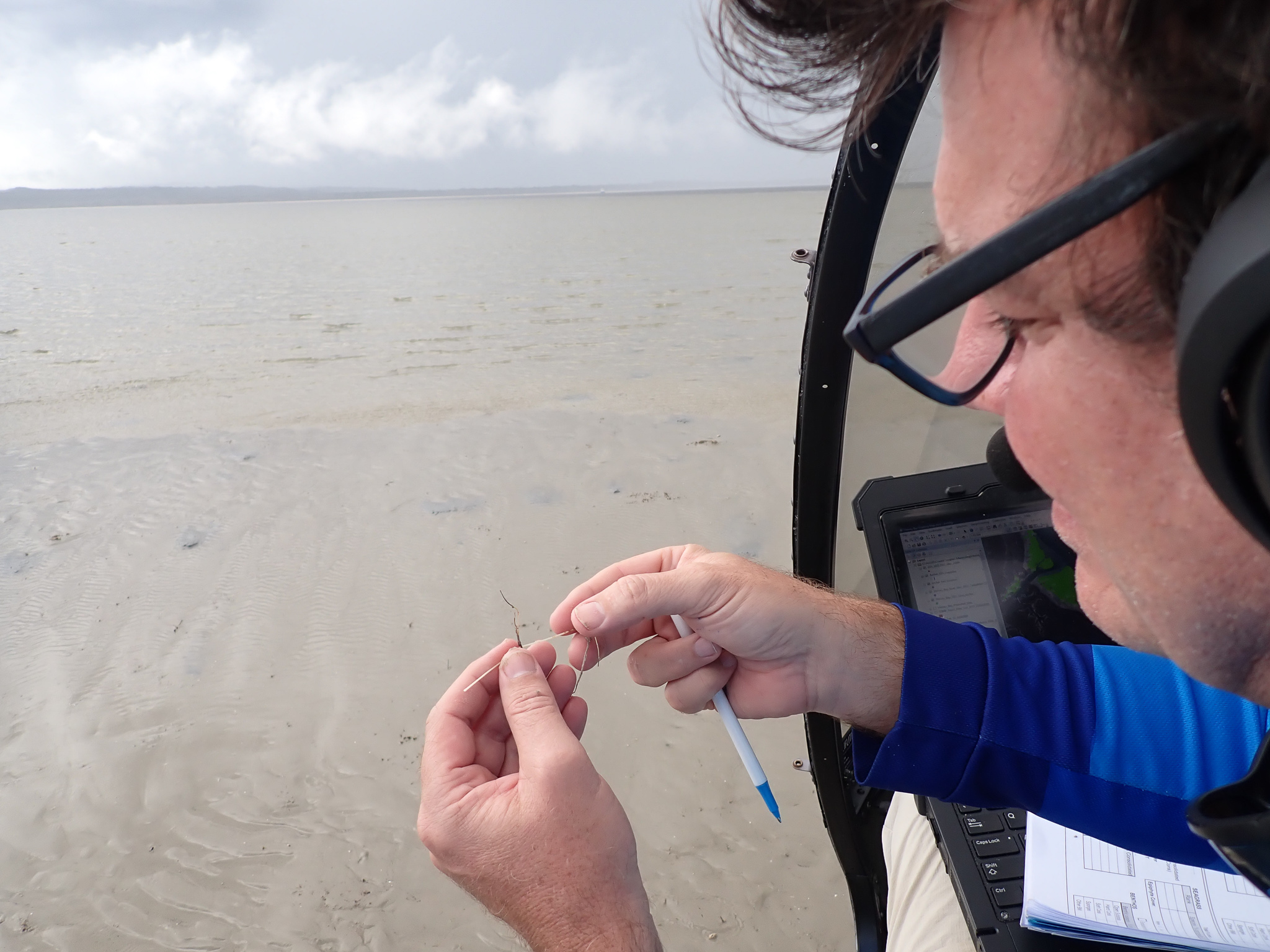
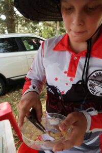
The recent 2021 Barra Bash at Lake Tinaroo was about angler participation and the elusive big barramundi, but emerging citizen scientists also investigated an unwanted species that has become established in the reservoir. The annual fishing tournament is a premier event on the north Queensland angling calendar and is run superbly by the Tableland Fish Stocking Society.
This year junior anglers rallied behind the call to collect forktail catfish. Across the tournament 448 catfish were landed. One hundred of these specimens will be used for scientific purposes with a subsample already dissected by young anglers with the assistance of TropWATER fish ecologist, Dr Ebner (Ebb).
Junior anglers that took the opportunity to perform a dissection or preferred to watch, got the opportunity to check out a bit more of what is underneath the bonnet of Neoarius graffeii aka forktail catfish. This included measuring several bits and pieces including length, mouth size and gut length. Then it was down to business assessing stomach and intestine contents looking at bugs, redclaw and fish remains among other things. Ear bones were also extracted from the fish for later use in determining their age. In a couple of cases, the fish had well developed ovaries and the large eggs of the catfish were also measured. This led to wonderful conversations about the biology of this catfish species and native catfishes more generally.

Citizen scientist, Joel Nobelius, relished the opportunity to dissect a forktail catfish and is shown here measuring egg diameter (Photo: B. Ebner)

There were several vibrant exchanges of knowledge among the Tableland Fish Stocking Society members, the junior anglers, mums, dads, and a chatty scientist. Tournament organisers had a wealth of information on the history of the fishery, and the biology of the fishes, and the focus on catfish is now part of community dialogue regarding the established benefits of legal stockings of important target species such as the mighty barramundi, but also the risks and disbenefits of illegal and accidental stockings thanks to the unwanted forktail catfish.
Ebb noted that the project is being run by the Tablelands Regional Council and the initiative was developed with the help of Barron Catchment Care, the Tableland Fish Stocking Society, and a visiting scientist from the Australian National University. The next step is to investigate samples and work with the angling community to create awareness about pest fish issues in the region. Specifically, the goal is to expand knowledge of pest fishes beyond the well-known cases of tilapia invasion in the Wet Tropics. The work is proudly supported by the Queensland Government—Queensland Citizen Science Grants. Anglers are reminded they are legally allowed to be in possession of 20 forktail catfish.

Find out more Email Us Phone 07 4781 4073