Rangers take the lead as ‘eyes and ears’ of the Northern Great Barrier Reef

Rangers take the lead as ‘eyes and ears’ of the Northern Great Barrier Reef

In the lead up to National Reconciliation Week (27 May – 3 June), James Cook University’s scientists are this week upskilling Torres Strait rangers to be the eyes and ears in protecting seagrass meadows in the northernmost part of the Great Barrier Reef.

In one of the country’s most comprehensive seagrass monitoring programs, Torres Strait Regional Authority (TSRA) and JCU TropWATER Centre are together training rangers from remote island communities to monitor seagrass meadows in the nation’s far north.

TSRA Acting Chairperson Horace Baira said Green Island off Cairns – home to vital dugong and turtle seagrass habitat – provided the perfect training ground.

“Combining ancient knowledge and modern science is critical for conservation as we face climate impacts across the Torres Strait,” Mr Baira said.

“The ocean is the lifeblood of the Torres Strait and bringing together all fields of expertise will help protect this precious natural resource for current and future generations.”

JCU’s TropWATER Centre seagrass scientist Dr Alex Carter said the rangers were critical in regional assessments of seagrass condition in Torres Strait.

“This training week builds on a 15-year partnership that goes from strength to strength as it continues to grow with new monitoring locations added to the network,” she said.

“Traditional Owners are the eyes and ears on the ground and this ranger-led program provides the first warnings of any declines or changes in seagrass health.

“This allows for quick management responses and targeted research projects to protect these important seagrass meadows.”

The four-day workshop, delivered by JCU scientists and TSRA, includes in-field training, species identification, and an opportunity to discuss results from recent research and monitoring projects to plan for future opportunities.

24-year-old Iama (Yam) Island Traditional Owner and TSRA Marine Biologist Madeina David said the training would support reef monitoring and results.

“Most people are unaware the Torres Strait is the most northern part of the Great Barrier Reef, home to the world’s largest dugong population and significant numbers of green turtles,” Ms David said.

“Working in partnership to value both traditional and western science gives our marine life and ocean ecosystems the best chance to survive and thrive.”

Meriam Traditional Owner and TSRA Senior Ranger Supervisor Aaron Bon said the training would build the capacity and knowledge of local Torres Strait Islander and Aboriginal rangers and boost conservation efforts across the Torres Strait.

“It will also assist Rangers and Traditional Owners to keep an eye on our reefs and seagrass meadows in the region and in doing so, we help protect some of the world’s most pristine and rich sea country,” Mr Bon said.

“Rangers will bring back skills, share learnings to support our important work on land and sea country in remote island communities and help us to make informed decisions around where we need to target our conservation efforts.”

TSRA employs up to 60 land and sea rangers across 14 Torres Strait communities to support employment opportunities for local people to combine traditional knowledge with conservation training to protect and manage land, sea and culture.
 

Turtles, dugongs in danger from seagrass loss

Large-scale monitoring of seagrass meadows across Hervey Bay and the Great Sandy Strait reveals there’s almost no seagrass remaining across most of previously mapped areas.

The surveys come after two significant flood events in early 2022, and scientists are concerned the seagrass loss could trigger an increase in dugong and green sea turtle strandings.

James Cook University TropWATER Centre is leading the monitoring of 2300km2 of seagrass meadows – one of the largest and most important areas of seagrass in eastern Australia – in partnership with the Department of Environment and Science (DES).

TropWATER Professor Michael Rasheed said there had been drastic reduction of seagrass when compared with previous extensive mapping.

“Our boat surveys show there’s almost no seagrass visible in the 2m to 17m depth range for much of the deeper meadows, and these sites have previously recorded extensive areas of seagrass,” he said.

“There were some areas of sub-tidal seagrass but these were confined to the deepest areas in the northern part of the bay.

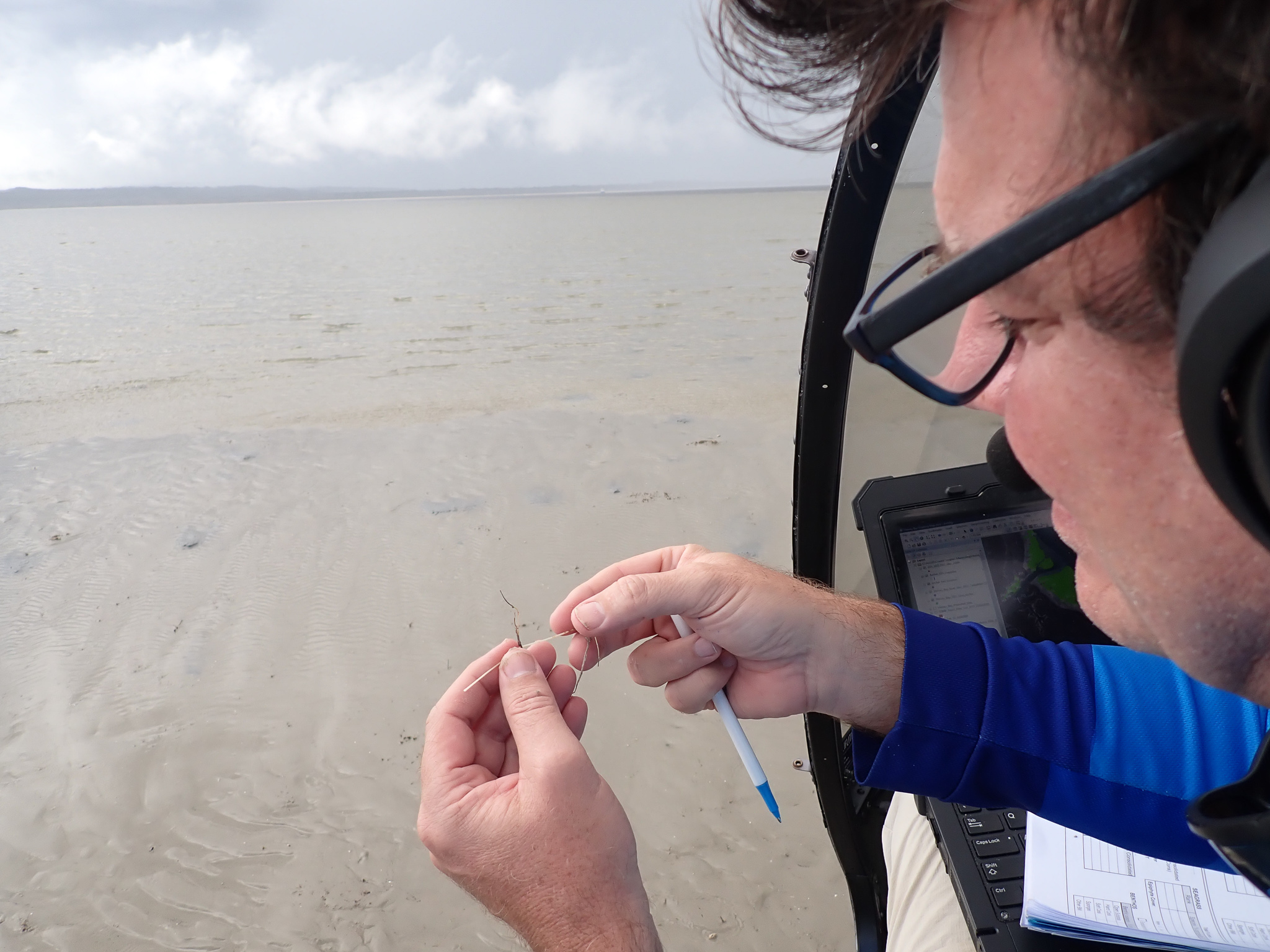
“We also used helicopters to assess more than 1300 intertidal sites throughout the Great Sandy Straits and while some sites had seagrass the cover was typically less than one percent of the seafloor offering scant resources for dugong and turtle.”

Prof Rasheed said the last comprehensive mapping of the entire area was more than 20 years ago, and surveys now were critical to help understand what seagrass resource remains to support dugong and turtle feeding as well as assess the potential for recovery over the coming months.

“However, we are in the low season for seagrass growth and about to enter the recovery period for seagrasses, so we hope to return to these waters in September/October, the normal seasonal peak for seagrasses, to look at how much of the seagrass has recovered.

“The good news is that there is still some seagrass remaining and this can provide the source for recovery in the coming months if conditions are favourable.”

In 1991 the same region experienced back-to-back floods causing more than 1000 km2 of seagrass loss.

Sediment in the floodwaters is known to reduce light and smother seagrass meadows, potentially depleting the main food source for dugong and turtles in the area.

The following year saw the highest recorded mortality of dugong, including a 20 per cent decline in dugong calves.

Queensland Parks and Wildlife Service Senior Ranger Dan Clifton said rangers had seen an increase in marine strandings within the Great Sandy Marine Park over the past 12 months, with the recent floods contributing to the issue.

“Since July 2021 we have recorded more than 240 stranded marine turtles and 22 stranded dugongs in this area as a result of different factors including boat strike and poor health,” Senior Ranger Clifton said.

“These numbers are significantly greater than the long-term average in the area.

“We have also recently seen large, mature green turtles presenting with an ulcerative skin disease affecting the carapace and flippers. This is currently being investigated by leading authorities to determine causes so we can respond accordingly.

“The issues currently faced by marine wildlife in the Great Sandy Marine Park demonstrate the importance of ongoing research and surveys so that we can identify and respond to threats and how critical it is that we protect our precious ecosystems.”

Alongside the seagrass monitoring, TropWATER researcher and dugong expert Dr Chris Cleguer is trialling the use of drones to monitor the body condition of the dugongs in the area.

“Extensive seagrass loss can have dramatic impact on dugongs and sea turtles. Dugongs may stop breeding, some will move and some will die,” he said.

“Assessing changes in the body condition of dugongs can help us monitor the health of the animals following the flooding events in the Hervey Bay region.

“Drones are increasingly used as a low-cost, non-invasive approach to obtain morphometric measurements of marine mammal body size. It’s been done for whales and manatees, and now we’re starting to collect data to do the same for dugongs.”

The large-scale monitoring also includes the collection of sediment samples from the seafloor to better characterise the fine sediment that surrounds the seagrass meadows and the source of these sediments.

TropWATER researchers and rangers from Queensland Parks and Wildlife Services will today finish the 14-day assessment of deep-water and shallow-water habitats across Hervey Bay and the Great Sandy Strait, using aerial and boat surveys.

Final results from the survey will be available in the coming months.

Dramatic loss of globe’s wetlands

Researchers analysing more than one-million satellite images have discovered 4,000 square kilometres of tidal wetlands have been lost globally over twenty years – but ecosystem restoration and natural processes are playing a part in reducing total losses.

Dr Nicholas Murray, Senior Lecturer and head of James Cook University’s Global Ecology Lab, led the study. He said global change and human actions are driving rapid changes of tidal wetlands —tidal marshes, mangroves and tidal flats — worldwide.

“But efforts to estimate their current and future status at the global scale remain highly unclear due to uncertainty about how tidal wetlands respond to drivers of change.

“We wanted to address that, so we developed a machine-learning analysis of vast archives of historical satellite images to detect the extent, timing and type of change across the world’s tidal wetlands between 1999 and 2019,” said Dr Murray.

TropWATER’s Nathan Waltham, and co-author on the study, said wetland loss in the Great Barrier Reef was a major concern.

“Coastal wetlands provide many services such as habitat for fish, cultural values, carbon storage and water quality,”  said Dr Waltham.

“We are working closely with many partners including NRM groups, farmers, Land and Sea Ranger groups, government and industry to protect and restore coastal wetlands at home here – but it is a big job and much work is needed.”

Dr Murray said that globally, 13,700 square kilometres of tidal wetlands were lost, offset by gains of 9,700 square kilometres, leading to a net loss of 4000 square kilometres over the two-decade period.

“We found 27 per cent of losses and gains were associated with direct human activities, such as conversion to agriculture and restoration of lost wetlands. All other changes were attributed to indirect drivers such as human impacts to river catchments, extensive development in the coastal zone, coastal subsidence, natural coastal processes and climate change,” said Dr Murray.

He said about three-quarters of the net global tidal wetland decrease happened in Asia, with almost 70 per cent of that total concentrated in Indonesia, China and Myanmar.

“Asia is the global centre of tidal wetland loss from direct human activities. These activities had a lesser role in the losses of tidal wetlands in Europe, Africa, the Americas and Oceania, where coastal wetland dynamics were driven by indirect factors such as wetland migration, coastal modifications and catchment change,” said Dr Murray.

The scientists found that almost three-quarters of tidal wetland loss globally has been offset by establishing new tidal wetlands in areas where they formerly did not occur – with notable expansion in the Ganges and Amazon deltas.

“Most new areas of tidal wetlands were the result of indirect drivers, highlighting the prominent role that broad-scale coastal processes have in maintaining tidal wetland extent and facilitating natural regeneration. This result indicates that we need to allow for the movement and migration of coastal wetlands to account for rapid global change,” said Dr Murray.

He said over one billion people now live in low-elevation coastal areas globally.
“Tidal wetlands are of immense importance to humanity, providing benefits such as carbon storage and sequestration, coastal protection, and fisheries enhancement.
“Global-scale monitoring is now essential if we are going to manage changes in coastal environments effectively,” said Dr Murray.

Wuthathi Land and Sea Custodians partner with TropWATER scientists

Wuthathi Land and Sea Custodians will use drone, helicopter and drop camera surveys to map seagrass habitats on Wuthathi Sea Country in Northern Cape York, in partnership with TropWATER scientists.

Combining cutting-edge technology, science and Traditional Ecological knowledge, the data collected will give Land and Sea Custodians and Traditional Owners the tools to develop plans for future monitoring and management of seagrass on Wuthathi Sea Country.

TropWATER is working alongside Wuthathi Land and Sea Custodians to conduct these surveys, helping to develop capacity in drone flight path programming, image collection and recording of data on sea grass habitat.

The partnership will expand to helicopter and drop camera survey training later this year, where Wuthathi Land and Sea Custodians will be upskilled to undertake aerial and subtidal surveys to monitor inshore seagrass meadows.

The program is funded by the partnership between the Australian Government’s Reef Trust and the Great Barrier Reef Foundation.


Long lost ‘bum-breathing’ turtle makes its return

A revolutionary new DNA detection method has helped rediscover an iconic species of turtle last seen more than 25 years ago in a northern Queensland river.

Water samples taken from the lower Burdekin River by a James Cook University-led team of researchers and analysed for environmental DNA (eDNA) confirmed the presence of the Irwin’s turtle at many sites along the river, which has not been formally recorded in the area for more than 25 years.

The turtle, first discovered in the Burdekin catchment by the late Steve Irwin and his father Bob in the early 1990s, is among a number of freshwater species which uses its cloaca (equivalent to its bum) to breathe while underwater, thus able to stay submerged underwater for longer.

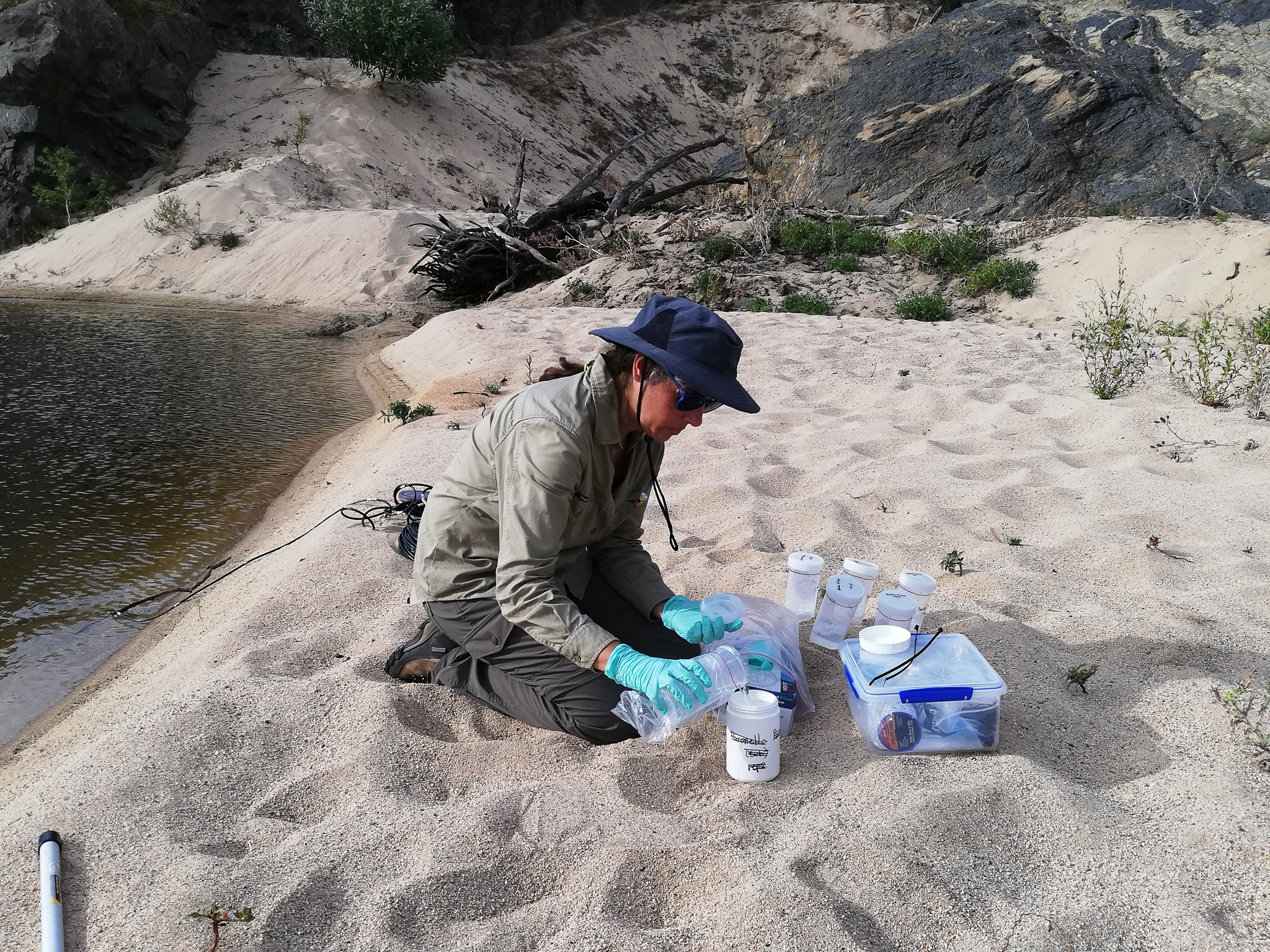
Centre for Tropical Water and Aquatic Ecosystem Research (TropWATER) Director Professor Damien Burrows and Research Officers Dr Cecilia Villacorta-Rath and Jason Schaffer teamed up with a State Government agency, a consultancy firm and Traditional Owners to survey the Burdekin, Bowen and Broken rivers for the elusive turtle.

“Until this rediscovery, we didn’t have any formal records to prove that the Irwin’s turtle was still living in the lower Burdekin River, and that river has changed a lot since the construction of the Burdekin Falls Dam,” Prof Burrows said.

“It’s reassuring to know they are still living there.”

The survey findings, co-authored by the JCU team and the Department of Regional Development, Manufacturing and Water’s Thomas Espinoza and Bernie Cockayne, were published this week in BMC Ecology and Evolution journal following two years of research comprising three separate survey periods over 2020 and 2021.

Funded by the National Environmental Science Program, 37 sites were investigated across the three river catchments, some of which involved the use of helicopters to get in and out.

Prof Burrows said eDNA technology was vital to the rediscovery of the turtle in the lower Burdekin River and had the potential to revolutionise how researchers tracked and located both aquatic and land-based animals.

“Previously, it’s been very difficult to sample for the Irwin’s turtle because they only live in places where there are crocodiles, or in upland tributaries which are very hard to access,” he said.

“They also don’t come into traps easily and the water they are living in in the Burdekin isn’t clear so you can’t put in underwater cameras to see them.

“But now with eDNA, all we had to do was take a water sample and analyse for their DNA.”

With the new process, DNA itself can be extracted and amplified directly from environmental samples such as soil, sediment and water without having to catch the target organism.

Dr Villacorta-Rath said while the eDNA samples taken by the team could not determine the age of the turtles found in the lower Burdekin and other rivers surveyed, the results were potentially game-changing.

“With the original site samples that we took in 2020, we had the beginnings of the story, but we needed to investigate further and go closer to the dam and see where was the uppermost distribution of the species,” she said.

“We don’t know anything about the demographics of this population, but the fact we have found their eDNA now, despite the dam being built in the 1980s, could point to adult Irwin’s turtles being able to survive in these more turbid water conditions.

“This rediscovery has now challenged the previous hypothesis that the species could not survive in these conditions.”

The information gathered will also help the State Government as it evaluates a proposal to build a dam in the upper reaches of Broken River at Urannah Station

Find out more Email Us Phone 07 4781 4073