JCU TropWATER researchers are investigating the challenges associated with developing water security in Northern Australia, particularly in regions celebrated for their ecological richness and diversity.
Under the Water Security for Northern Australia program, scientists from JCU TropWATER, Charles Darwin University and CQ University are examining targeted catchments from Western Australia to eastern Queensland, including the Gilbert River, Lower Fitzroy River, Daly River, and Ord River irrigation area.
JCU TropWATER Director Professor Damien Burrows said the amount of water needed for Australia’s agriculture will continue to grow along with the global population, and this has placed inevitable pressure on securing water from natural waterways.
“As we explore water security in Northern Australia, there’s a critical need to find a balance between meeting human needs and preserving the environment, while understanding the limitations to potential development,” he said.
“Science is critical in guiding these development decisions, particularly given the arid and challenging climate conditions of Northern Australia, coupled with few suitable catchments.
“Our challenge is to maximise these constrained opportunities through rigorous scientific measures, ensuring environmental preservation amid economic aspirations.”
Unravelling the impact of development on Northern Australia’s ecological values
With nearly half of Australia’s total land area and only 5% of the population, coupled with ample rainfall and abundant water resources, Northern Australia is a favourable region for water security for agricultural expansion.
Yet, while Northern Australia is recognised for its economic potential, it’s also ecologically important, renowned for vast, biodiverse aquatic ecosystems. Beyond this, the landscape also holds high cultural importance for Indigenous communities, who have maintained a deep connection with the land for generations.
TropWATER’s Dr Paula Cartwright said the region boasts countless wetlands with natural wet-dry seasonal cycles, housing a unique collection of fauna and flora that only exist under these conditions.
“The region features diverse ecosystems, where freshwater systems seamlessly connect to vital mangrove habitats and other marine ecosystems, allowing for biodiversity to thrive,” she said.
“The area’s natural wet-dry cycles also play a pivotal role in supporting the survival of distinctive species, such as the sawfish and global migratory birds.”
Dr Cartwright said that without environmental research, building infrastructure to secure water could disrupt water quality and the natural flow essential to ecosystems in both wet and dry seasons.
“Interfering with natural waterways can have far-reaching consequences, affecting migration patterns, sediment movement, nutrient cycling, and temperature. These disruptions, in turn, could have cascading effects on the diverse fauna and flora, including vulnerable species like the sawfish,” she said.
“Understanding the risks and implementing sustainable water management solutions means we can mitigate these disruptions and preserve the ecological integrity of water systems.”
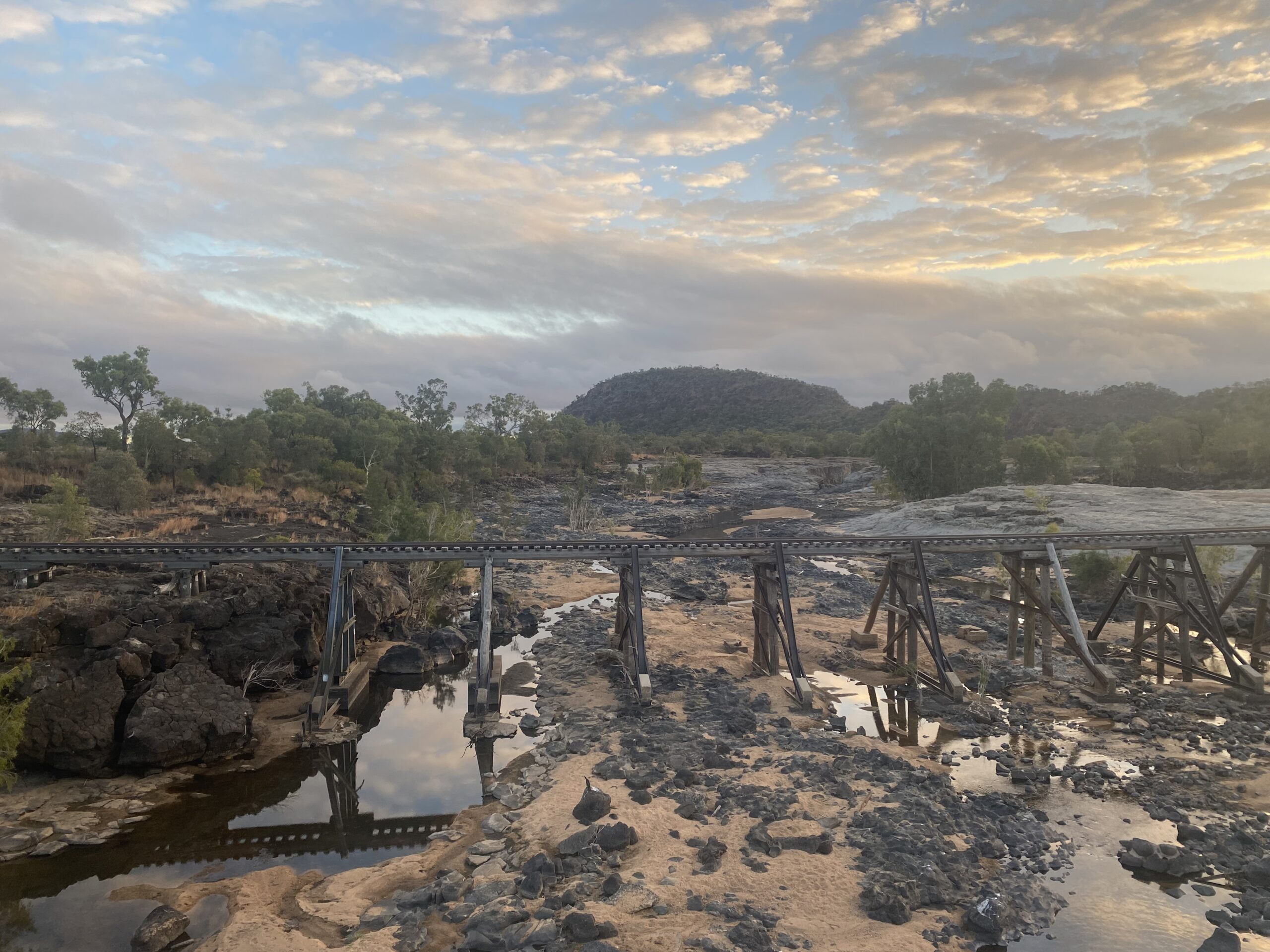
 A case study: a close look at the Queensland’s Gilbert River catchment
One region TropWATER scientists are investigating is Queensland’s Gilbert River catchment. It has been highlighted as containing critical habitats for aquatic species as well as seasonal watering holes for many terrestrial species.
Freshwater sawfish are a major focus for scientists in this area, with the species listed as endangered under state and federal legislation. Prawns and barramundi, both significant recreational and commercial industries, also rely on the water connectivity between salt and freshwater systems in this catchment.
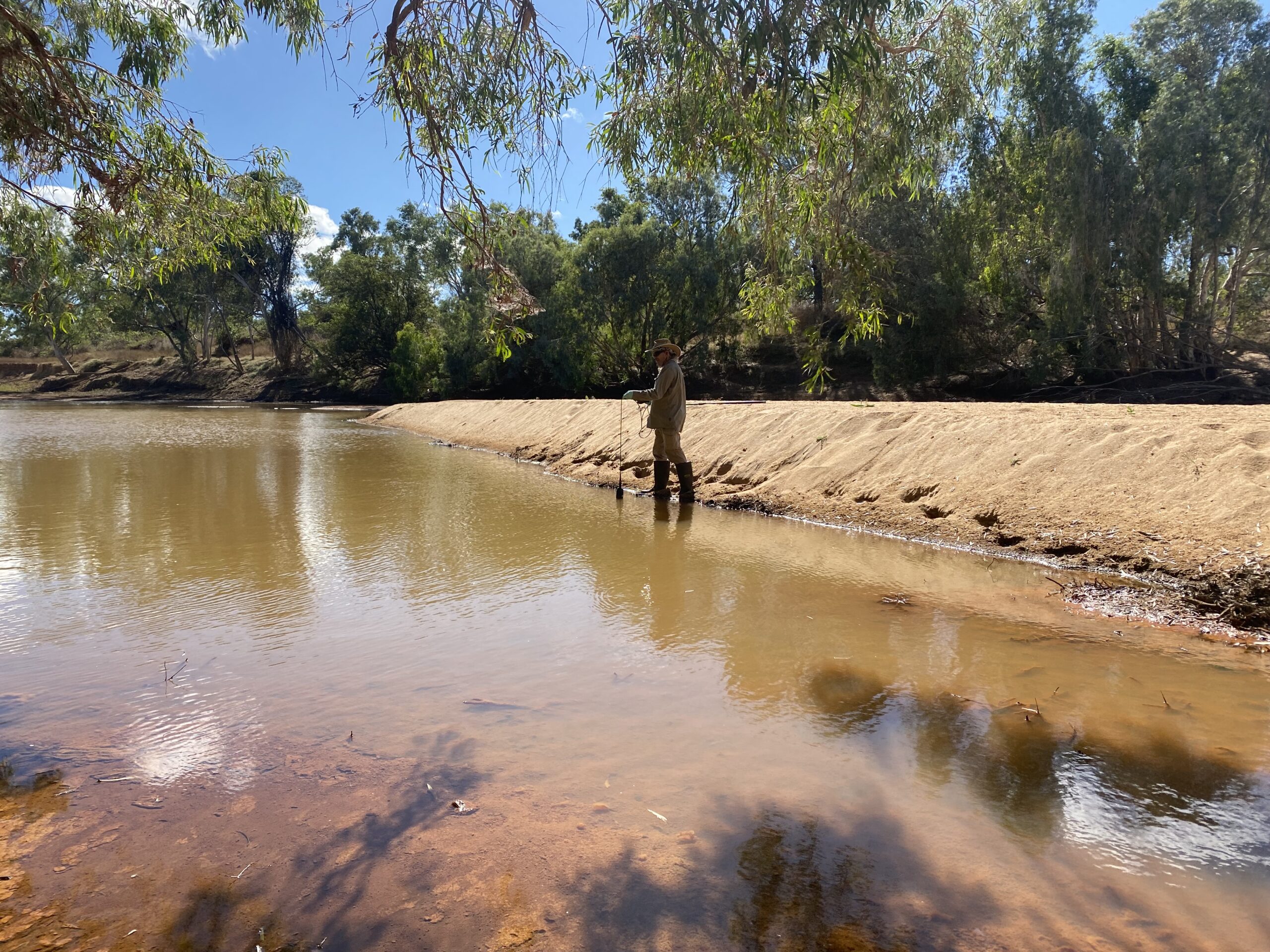
Dr Cartwright said the team would survey across floodplains, rivers, and tributaries, to identify the diversity of aquatic and terrestrial species, using advanced technologies like eDNA sampling, sound bars, and in-water camera surveys.
“We’ll also use long-term satellite data to map waterhole fluctuations through wet and dry seasons and hydrology data to better understand groundwater/surface water interactions across the system,” she said.
“Together, an understanding of species distribution and their interaction through food webs, along with mapping of the interannual variability in waterholes, will allow us to pinpoint what is most sensitive to disruption of seasonal waterflows.”
“This helps identify areas at high ecological risk and those that can withstand certain levels of development without causing significant environmental harm.”
What next, in 2024?
In 2024, the Water Security for Northern Australia program builds upon the groundwork laid in 2023, conducting comprehensive desktop analyses and fieldwork in the Gilbert, Ord, Fitzroy, and Daly River catchments.
Post-wet season, researchers will address data gaps and explore the impact of varying wet season rainfall on species distribution and waterhole ecology.
The three-year program will continue to unravel the complexities of water security, ecology, and development to allow sustainable development.