Gulf mangrove dieback discovery

Breakthrough research by James Cook University scientists has solved the mystery of the catastrophic death of 40 million mangrove trees around the Gulf of Carpentaria in 2016 – and the discovery could help scientists predict, and possibly prevent, future events.

The latest research reveals that the devastating mass death of tidal mangrove forests was a result of an unusually low sea-level due to large-scale swings in El Nino – Southern Oscillation events.

Lead author Dr Norm Duke from JCU’s TropWATER Research Centre said the mangroves had not recovered seven years on, making the mangrove dieback event an ongoing coastal catastrophe.

“The key factor responsible for the mass dieback appears to have been the sudden 40-centimetre drop in sea level that lasted for about six months, coinciding with no rainfall, killing vast areas of mangroves,” he said.

“Essentially, the trees died of thirst.”

The study shows that strong El Niño events – often associated with coral bleaching on the Great Barrier Reef – are also a threat to vital mangrove ecosystems.

Nearly 40 million mangrove trees died along 2000 kilometres of coastline in northern Australia’s remote Gulf region, releasing nearly one million tonnes of carbon. More than 76 km2 of mangroves were lost, making this the worst incidence of climate-related mass tree dieback that has ever occurred globally.

“Recovery has been repeatedly stymied by other climate-driven events including severe cyclones and flooding,” Dr Duke said.

Author assisting with data analysis and JCU TropWATER Researcher Dr Adam Canning said the study’s evidence for sea-level drop being the cause was found in the discovery of an earlier mass dieback in 1982, observed in satellite imagery.

“The 1982 dieback also coincided with an unusually extreme drop in sea level during another very severe El Niño event. We know from satellite data that the mangroves took at least 15 years to recover from that dieback,” he said.

“Now they are caught in a vicious collapse and recovery cycle because of repeated pressure from climate change – the question remains when or if they will recover.”

Enhancing the resilience of these ecosystems is possible with targeted action.

Co-author and wetlands researcher at Earthwatch Australia, Jock Mackenzie, said “To help mangrove ecosystems respond to environmental impacts such as climate change, we must address the localised human impacts that degrade mangrove habitats including pollution, altered hydrology, feral animals, weeds, and improper fire management. These impacts impede the natural ability of mangroves to adapt to climate change.”

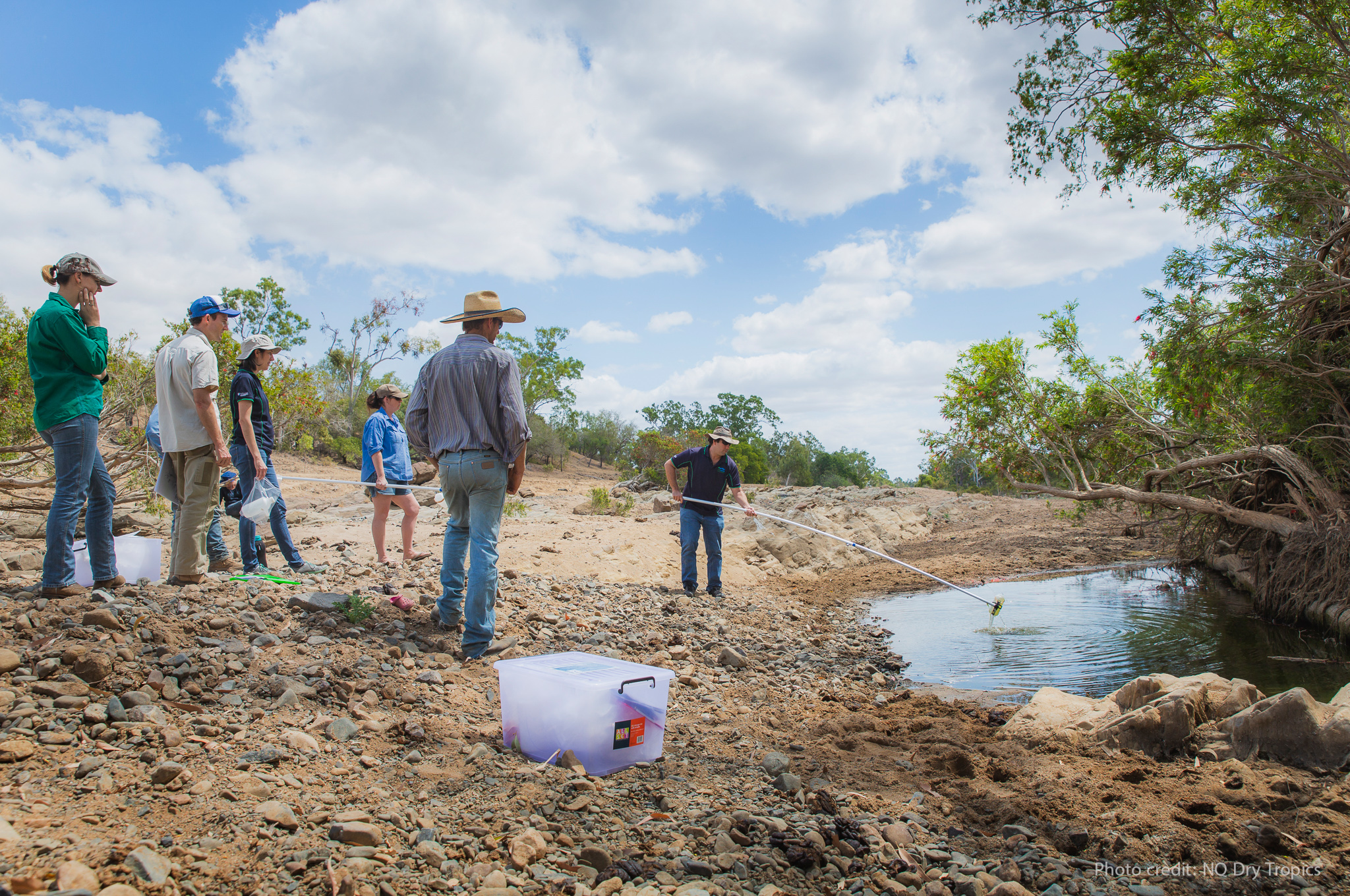
“We encourage community groups, Indigenous custodians and catchment management agencies to continue to monitor mangrove shorelines through a combination of satellite monitoring and the MangroveWatch citizen science program, to help identify and prioritise targeted local mangrove management and threat reduction.”

Satellite imagery could also be used to help monitor the recovery of mangroves in remote areas and identify key areas under pressure. It may even be possible to predict future events, which could help prepare for innovative rescue efforts that may include reducing water stress during El Niño events via targeted irrigation.

Dr Duke said mangroves are vital to the ecology and stability of tropical and sub-tropical coastlines and their protection is critical.

“They provide essential habitat for many species and can hold substantially more carbon than tropical forests within the same area,” he said.

“These extraordinary trees are normally environmentally resilient, being able to grow in seawater, intertidal zones and on coastal salt flats. They are also essential for preventing or reducing shoreline erosion and retreat.”

The dieback’s exact cause has been revealed after a four-year research partnership between James Cook University, Charles Darwin University, and Carpentaria Land Council Aboriginal Corporation Indigenous Rangers in the Gulf, funded by the Australian Government’s National Environmental Science Program and the Northern Territory Government.

The Gulf mangrove dieback research project and team was funded by the Australian Government’s National Environmental Science Program (NESP), through both its Tropical Water Quality Hub and Northern Australia Environmental Resources Hub.

Scholarship gives marine science students real world opportunity

Two outstanding James Cook University (JCU) marine science students have been awarded Bachelor of Science scholarships – equipping them with unique real-world experience on the Great Barrier Reef under the guidance of leading marine researchers.

Jordan Wells and Indus Fisher will receive financial support throughout each year of their degree, in addition to the chance to work alongside researchers and port industry managers, thanks to a partnership between JCU and North Queensland Bulk Ports Corporation (NQBP).

JCU’s Centre for Tropical Water and Aquatic Ecosystem Research (TropWATER) Principal Researcher Dr Nathan Waltham said the scholarship would be invaluable for the budding marine scientists.

“Every year Jordan and Indus will have financial support, plus get hands-on experience in understanding how environmental science can tackle real marine industry issues,” he said.

“Marine science can be a very competitive field and this scholarship gives these promising students valuable real-world experiences, beyond just the classroom.”

Indus Fisher, who relocated to Townsville from Mackay, said he had grown up in the heart of the Great Barrier Reef and loved the marine environment from a young age.

“With a hope to help protect this beautiful ecosystem, I couldn’t think of a better place to learn the knowledge and skills to do so than at the world’s leading university in marine science,” he said.

“Thanks to the generosity of North Queensland Bulk Ports and JCU TropWATER, this financial burden has been greatly reduced, allowing me to focus more fully on my studies and achieve the very best possible results I can.

“The real opportunity lies in the industry connections, placement possibilities, and real-world experience this fantastic partnership makes available to us.”

The two students will join last year’s scholarship recipient, Amy Cantrill, and intern students who will complete placement in the environmental team at NQBP. Together, the student programs are building the next generation of marine scientists to be job ready.

NQBP CEO Nicolas Fertin said the port authority is proud to provide university students real-world experience in port environmental management.

“With JCU, we have created one of Australia’s most comprehensive port marine ambient monitoring programs while training the next generation of industry and job-ready science graduates,” Mr Fertin said.

“The marine environment is central in our everyday planning and port operations. Informed environmental management ensures trade keeps flowing to service the Queensland economy.”

JCU offers the world’s best marine and freshwater biology degrees, and NQBP is the only port authority in the world with three priority ports, of Hay Point, Mackay and Abbot Point, located on the shores of a World Heritage Area.

The scholarship program is part of NQBP’s broader five-year partnership with JCU, where researchers monitor the local marine environment surrounding four ports.

Jordan Wells (left) and Indus Fisher (right) have been awarded Bachelor of Science scholarships for 2022, joining 2021 recipient Amy Cantrill (centre).

Identifying sediments in the Bowen, Broken and Bogie catchments

Graziers and scientists are working together to understand how, when and where sediment moves from the land into the Bowen, Broken and Bogie catchments – building a more accurate understanding of the local water quality.

Over the past four wet seasons, JCU TropWATER scientists Zoe Bainbridge and Steve Lewis have worked with local graziers and NQ Dry Tropics’ Landholders Driving Change project team to run the LDC Community Water Quality Monitoring Group, collecting and analysing water samples across nine river and creek sites during high rainfall events.

The program is helping improve scientists’ and landholders’ understanding of the loss of soil, and the nutrients attached to this soil, that travel from the land into waterways during high rainfall.

“The aim is to help identify the main source areas of sediment within the catchment, and work with landholders to prevent fine sediment flowing out to the Great Barrier Reef,” researcher Zoe Bainbridge said.

Latest results: The 2021-22 wet season

Despite limited rainfall in the Collinsville region this wet season, more than 50 water samples were collected by graziers during local streamflow events and delivered to TropWATER to be analysed for phosphorous, nitrogen and sediment content.

Early results show the Bowen River sub-catchment is an area highly susceptible to soil loss, most likely due to soil types prone to erosion.

The full report will be available later this year.

Big picture: how the data will be used

The water quality data collected from this project is paired with historical water quality and sediment source tracing data, giving an improved understanding of the sediment sources and transport processes within these catchments.

These valuable datasets are being used by the Paddock to Reef Program’s catchment modellers to improve the spatial model representation of water quality across the Bowen Broken and Bogie catchments, including how this relates to land management changes within the catchment.

LDC Community Water Quality Monitoring Project is a collaborative between NQ Dry Tropics’ Landholders Driving Change and JCU TropWATER Centre, funded by the partnership between the Australian Government’s Reef Trust and the Great Barrier Reef Foundation, and the Office of the Great Barrier Reef.

Find out more Email Us Phone 07 4781 4073