
Far North Queensland
Location
We are working with four Traditional Owner Land and Sea Ranger groups to monitor seagrass recovery along coastlines affected by flooding associated with Tropical Cyclone Jasper in 2023.
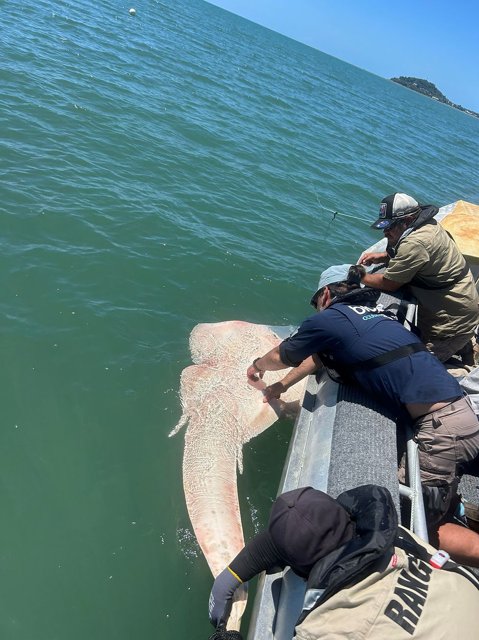
We are also mapping food webs and tracking shark and ray movements to understand connections between seagrass meadows and culturally important marine megafauna.
The project will build Ranger capacity to independently lead long-term seagrass monitoring on their Sea Country.
Key points
Seagrass recovery and food web monitoring with Rangers in northeast Queensland
Building on the post Tropical Cyclone Jasper habitat assessments
Tropical Cyclone Jasper made landfall in far north Queensland in December 2023, bringing record rainfall and widespread flooding that smothered coastal habitats in sediment. The affected coastline, from the Bloomfield River to Yarrabah, supports seagrass meadows that are feeding grounds for dugongs and marine turtles, nursery habitats for juvenile fish, and connect to populations of sharks and rays that play a functional, structuring role in food webs, and hold cultural significance for Traditional Owners.
Our researchers surveyed over 250 km of coastline in the affected region in 2024 and 2025 to assess initial impacts and recovery of seagrass meadows, mangroves, and inshore reefs after the flooding. While seagrass showed early signs of recovery, a lack of long-term monitoring data for these meadows made it difficult to assess the extent of damage.
Long-term seagrass monitoring with four Ranger groups
We are partnering with Dabu Jajikal, Jabalbina, Dawul Wuru (Yirrganydji) and Gunggandji Land and Sea Rangers to track the recovery of four seagrass meadows identified in the 2024/2025 surveys:
Kangkiji Beach (Dabu Jajikal)
Cooya Beach (Jabalbina)
Double Island (Dawul Wuru)
Mission Bay (Gunggandji)
Our researchers will train Rangers in standardised monitoring methods using our resources and reference guides, building capacity for Rangers to independently lead monitoring on Sea Country with our science support. Together, we will survey seagrass meadows before and after the wet seasons of 2026 and 2027, tracking habitat condition and recovery over time.
Mapping food webs and tracking megafauna
In addition to seagrass monitoring, we are working with Dawul Wuru and Jabalbina Rangers and the Biopixel Oceans Foundation to understand how seagrass recovery connects to the wider food web at Cooya Beach and Double Island.
The team will use stable isotope analysis to trace food web connections from seagrass through to sharks and rays and acoustic and satellite tags to track the movements of marine megafauna. Acoustic tags use a network of over 300 acoustic receivers currently deployed along the Queensland coast, allowing us to track the movements of any acoustically tagged animals that come and go from a much larger area over multiple years. Satellite tracking provides an immediate, live feed of animal movements that can be shared with the public to understand large scale movement patterns. Animals tracked in this project and other collaborative work can be viewed at biotracker.tv.
This work will help identify critical habitat and movement patterns for threatened species and inform Traditional Owner Sea Country management plans.
Project details
This project is supported by the Australian and Queensland governments through the Disaster Recovery Funding Arrangements and Biodiversity Conservation Program. Project partners include Dabu Jajikal, Jabalbina, Dawul Wuru, and Gunggandji Land and Sea Rangers and Biopixel Oceans Foundation’s Adam Barnett and Katya Abrantes.
Research support


Research leads


