Northern Australia
Location
We are partnering with Indigenous Rangers across northern Australia to provide hands-on skills training and online resources to establish Ranger-led seagrass monitoring programs.
These programs will increase our understanding of seagrass communities across northern Australia and contribute to Ranger-led management of Sea Country.
Training videos and guides developed as part of this project will become publicly available resources to support current and future Ranger-led seagrass monitoring.
Key points
Establishing Ranger-led seagrass monitoring programs
Seagrass in northern Australia
Northern Australia’s seagrass meadows stretch from Queensland’s tropical north and Torres Strait, across the Gulf of Carpentaria, and along the Northern Territory and northern Western Australian coastlines. They provide a range of valuable ecosystem services, from storing carbon and supporting fisheries to offering habitats to many threatened species, such as dugongs and turtles.
But seagrasses face many threats, and monitoring the distribution and condition of these meadows can guide conservation and management efforts. Many of these meadows lie in remote regions, where Indigenous Ranger groups are well-positioned to lead monitoring and management of these habitats while building on existing connections Sea Country.
For these Ranger-led programs to be effective, a consistent and comprehensive approach to monitoring is needed to support long-term investment. This includes maintaining up-to-date resources and ongoing skills training in monitoring tools and methods.
Co-design for sustainable monitoring
We are partnering with Indigenous Ranger groups across northern Australia to co-design seagrass monitoring programs. This is a highly coordinated approach, involving baseline surveys using helicopters, drones, and boats, training in standardised monitoring methods, and resources and reference guides to support ongoing, sustainable Ranger-led monitoring.
Hands-on training in survey methods include:
Helicopter surveys – for surveying large areas of intertidal seagrass, to establish a baseline and select intertidal monitoring locations.
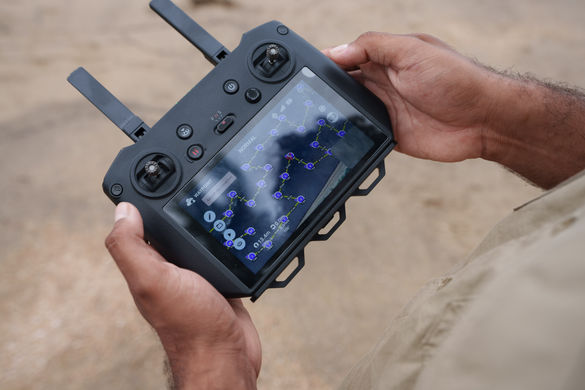
Drone surveys – for surveying small areas of intertidal seagrass, as a more affordable and accessible alternative to helicopter surveys.
Walking transects – for surveying areas of intertidal seagrass that are exposed at low tide, where safe to do so.
Boat-based towed and drop cameras – for surveying subtidal (submerged) seagrass habitats.
Boat-based van Veen grabs – for surveying subtidal (submerged) seagrass habitats when visibility is low.
Our researchers are also providing training in GIS skills to assess and manage collected monitoring data.
Establishing these Ranger-led monitoring programs will support Traditional Owner decision-making about local resources and management of Sea Country, including dugong and turtle management plans, help protect culturally and ecologically important habitats and species, and strengthen planning for long-term change.
Resources for training and engagement
We are developing visual and written guides to seagrass monitoring methods and species identification for northern Australia. These training materials will be valuable reference guides for partner Ranger groups undertaking monitoring and be made publicly available for others interested in establishing monitoring programs.
Training materials will include videos developed with a professional filmmaker as well as posters, flyers, and written manuals. Filming for training materials took place throughout 2025 with partner Ranger groups on Sea Country.
Project details
These projects are led by Dr Alex Carter and Dr Catherine Collier. Baseline surveys and monitoring programs are in partnership with Angkamuthi, Gangalidda-Garawa, Girringun, Karajarri, Kaurareg, Marra, South East Arnhem Land, Tiwi Islands, Torres Strait, Wellesley Islands, Wuthathi, and Yanyuwa Traditional Owners and Rangers.
Training materials are being developed in partnership with Girringun, Karajarri, Marra, and Torres Strait Traditional Owners and Rangers with funding from the National Environmental Science Program, the Northern Territory government, and the Great Barrier Reef Foundation.
Research support


Research leads


