
Explainer: Flood plumes
- emmarehn5
- Aug 18, 2025
- 2 min read

What is a flood plume?
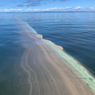
A flood plume – also known as a river plume – is a large volume of freshwater discharged from a river into the ocean, caused by heavy rainfall and flooding. Plumes can carry sediment, nutrients, pesticides and other contaminants from the land into coastal and marine waters.
How far the flood plume spreads depends on factors such as the volume of water discharged, wind and currents, and how long the flooding lasts.
How do flood plumes affect marine ecosystems?
Sediment and nutrients transported by flood plumes can have significant negative impacts on the health of inshore seagrass meadows and coral reefs by:
Reducing light – sediments suspended in water can limit the available light for plants to grow.
Smothering – silt and mud can cover seagrass and coral.
Increasing nutrients – higher nutrient levels can stimulate macroalgal growth, which can eventually outcompete corals and can cause coral disease and increased bioerosion.
Coastal and inshore areas are the most likely to be affected by flood plumes as they are located closer to the source of the plume, although larger plumes can carry suspended sediment and nutrients to mid and outer reefs. There is a lot of evidence about the impacts of flood plumes on inshore areas but less it known about impacts further offshore.
The severity of these impacts depends on the timing and size of the flood plume, the amount of sediments and nutrients carried by them, the health of the ecosystems prior to exposure to the plume, and whether other disturbances occur at the same time (such as cyclones or high temperatures).


Our work monitoring flood plumes
Our researchers have been studying how river runoff and flood plumes move within the Great Barrier Reef for over two decades. We also work with landholders and agricultural professionals to provide science-based solutions for improved farm management practices to reduce fertiliser and pesticide losses and manage soil erosion.
Our work includes:
Sampling flood plumes from major rivers across the Great Barrier Reef catchments.
Developing techniques to assess water quality remotely using satellite imagery.
Fine-scale monitoring of sediment and nutrient sources on agricultural lands, in collaboration with landholders.
Developing models to predict pollutant pathways and identify pollutant ‘hotspots’ for targeted management.
Related projects:

